 PM Modi visit USA
 Only the mirror in my washroom and phone gallery see the crazy me : Sara Khan
 Karnataka rain fury: Photos of flooded streets, uprooted trees
 Cannes 2022: Deepika Padukone stuns at the French Riviera in Sabyasachi outfit
 Ranbir Kapoor And Alia Bhatt's Wedding Pics - Sealed With A Kiss
 Oscars 2022: Every Academy Award Winner
 Shane Warne (1969-2022): Australian cricket legend's life in pictures
 Photos: What Russia's invasion of Ukraine looks like on the ground
 Lata Mangeshkar (1929-2022): A pictorial tribute to the 'Nightingale of India'
 PM Modi unveils 216-feet tall Statue of Equality in Hyderabad (PHOTOS)
The Badminton Association of India (BAI) has announced a 14-member-strong India squad for
- Men’s Sr Hockey Nationals to be played in division-based format from April 4
- Mensik denies Djokovic 100th title in Miami final
- KIPG: Son of a vegetable vendor, Bihar’s Jhandu Kumar eyes Worlds, 2028 Paralympics
- Hardik Singh credits hard work and team unity for receiving HI Midfielder of the Year award
- Djokovic, Alcaraz land in same half of Miami draw
Dana intensifies into severe cyclonic storm, to hit Odisha coast between Bhitarkanika and Dhamra Last Updated : 24 Oct 2024 10:39:53 AM IST 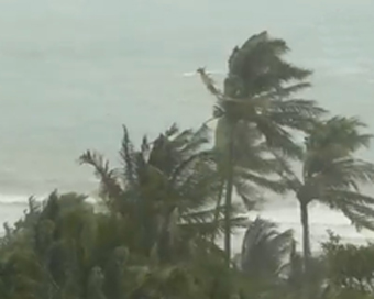
Dana intensifies into severe cyclonic storm, to hit Odisha coast between Bhitarkanika and Dhamra The cyclonic storm Dana developed over east-central Bay of Bengal has intensified into a 'severe' cyclonic storm.
The severe cyclonic storm is expected to hit the Odisha coast between Bhitarkanika in Kendrapara district and Dhamra in Bhadrak district on October 24 night and October 25 morning.
“The cyclonic storm 'DANA' (pronounced as Dana) over east-central and adjoining west-central Bay of Bengal moved north-northwestwards with a speed of 15 kmph during past six hours, intensified into a severe cyclonic storm over central and adjoining northwest Bay of Bengal,” said India Meteorological Department (IMD).
The severe cyclonic storm lay centred over the northwest and adjoining central Bay of Bengal, about 260 km southeast of Paradip (Odisha), 290 km south-southeast of Dhamara (Odisha) and 350 km south of Sagar Island (West Bengal).
It is very likely to move northwestwards and cross north Odisha and West Bengal coasts between Puri and Sagar Island close to Bhitarkanika and Dhamara (Odisha) from mid-night of October 24th to the morning of October 25 as a severe cyclonic storm with a wind speed of 100-110 kmph gusting to 120 kmph.
Meanwhile, coastal districts like Jagatsinghpur, Puri, Kendrapara, Bhadrak, and Balasore have been witnessing rainfall since Wednesday evening due to the effect of cyclone Dana which is fast approaching the Odisha coast. The wind speed in these places has been increasing continuously.
Director IMD Bhubaneswar, Manorama Mohanty on Thursday told media persons that Paradip experienced maximum rainfall of 51mm while the Chandbali area witnessed 39mm rainfall during the last 24 hours due to cyclone Dana. She also said that the cyclone will make landfall Thursday midnight and the process will continue till Friday morning.
It is pertinent here to mention that Chief Minister Mohan Charan Majhi has earlier said that around three lakh people have been evacuated from vulnerable areas in the affected districts till Wednesday evening. The state government had targeted to evacuate around 10 lakh people from vulnerable areas to safer places, cyclone shelters, and relief centres.
He had assured that the process of evacuation would be completed by the afternoon. The state government has created around 6,000 relief centres and cyclone shelters.IANS Bhubaneswar For Latest Updates Please-
Join us on
Follow us on


172.31.16.186


